2018 Waipahu Transit Oriented Development (TOD)
Design Futures Optimization- Dynamic Model
Assessing Transit-Oriented Development in Waipahu, Hawai‘i with UNA (Urban Network Analysis):
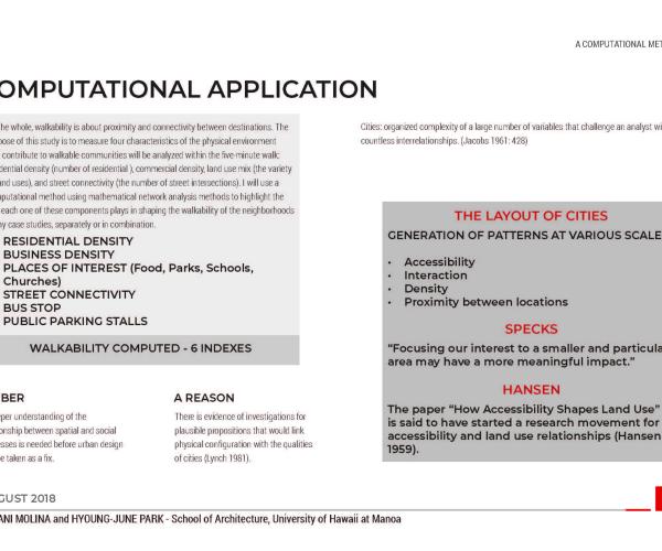
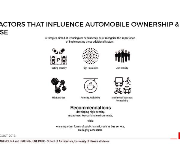
On the whole, walkability is about proximity and connectivity between destinations. The
purpose of this study is to measure four characteristics of the physical environment
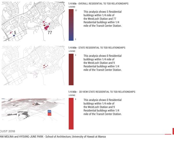
that contribute to walkable communities will be analyzed within the five-minute walk:residential density (number of residential ), commercial density, land use mix (the variety of land uses), and street connectivity (the number of street intersections). I will use a computational method using mathematical network analysis methods to highlight the role each one of these components plays in shaping the walkability of the neighborhoods of my case studies, separately or in combination.
WALKABILITY COMPUTED - 6 INDEXES
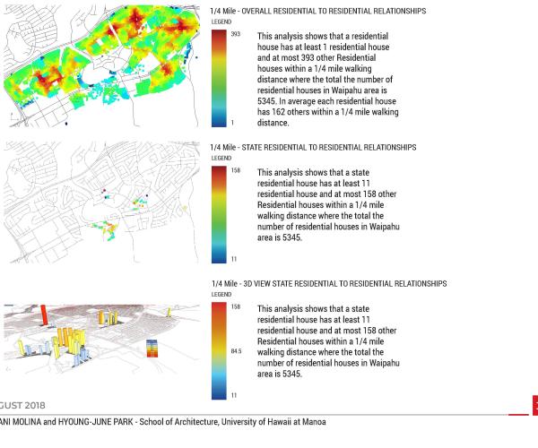
1. RESIDENTIAL DENSITY
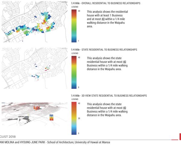
2. BUSINESS DENSITY
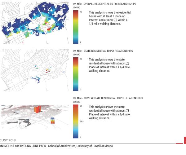
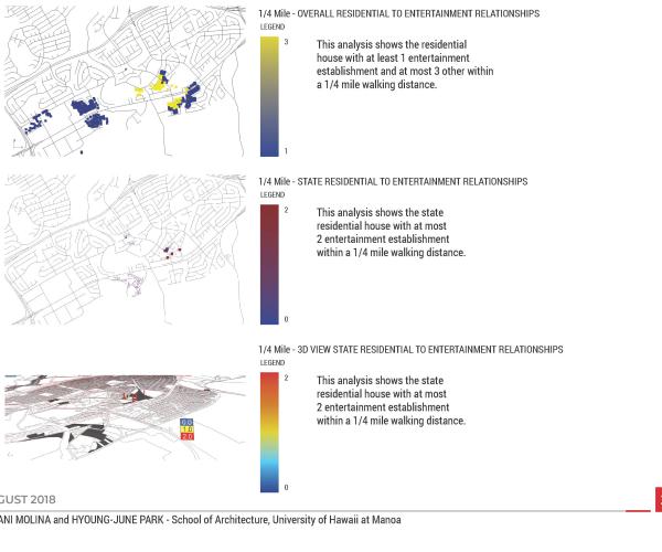
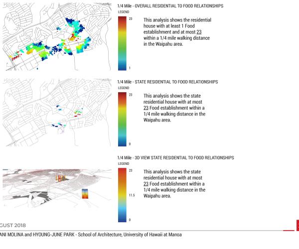
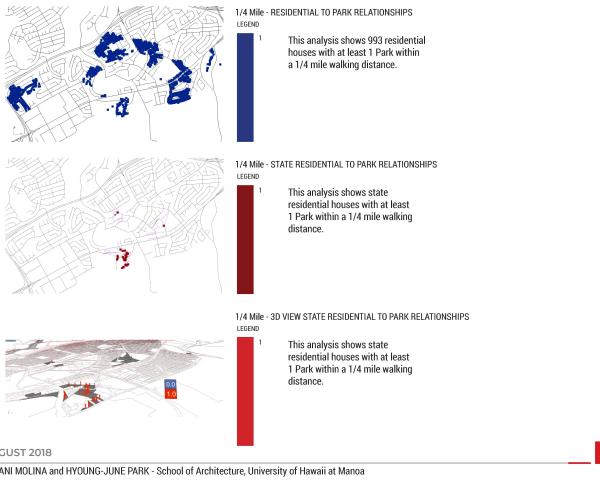
3. PLACES OF INTEREST (Food, Parks, Schools, Churches)
4. STREET CONNECTIVITY
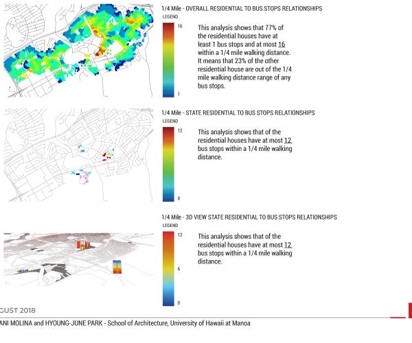
5. BUS STOP
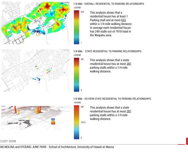
6. PUBLIC PARKING STALLS
DESCRIPTION
This project was the part of UHCDC Waipahu Collaboration.
UHCDC Waipahu Collaboration Project
Achievement: Honored with the 2020 ACSA Collaborative Practice Award, recognizing excellence in school-based community outreach programs.
Team Composition: A dynamic ensemble of 8 faculty members representing the School of Architecture, Department of Urban and Regional Planning, Public Policy Center, and Sea Grant College.
Objective: Seamlessly integrate six classes and eight research projects, all focused on transit-oriented development around the Waipahu station areas.
Deliverables:
- A comprehensive strategic planning study.
- A meticulous planning assessment.
- In-depth ecological hazards and asset studies.
- An exhaustive infrastructure and transportation study.
- Detailed tree canopy analysis.
- Flood mitigation guidelines.
- An innovative digital optimization model.
- A housing and block survey.
- A curated design considerations booklet.
Engagement: The team ardently organized numerous community outreach events, fostering a dialogue with various city and state agencies, and presenting to professional organizations, ensuring a holistic and inclusive approach to the development strategy.
Our understanding of where we live
is not so philosophical but rather pragmatic
Understanding urban environment with quantifiable measures has been the source of debates
Well then becomes the one of heated discussions … now possiblly the one of main trends

